Why intersections are the hardest moments for self-driving cars
Most driving is routine: you follow a lane, match speed, and react to the car ahead. Intersections break that pattern. Several flows of traffic overlap, the rules depend on timing and negotiation, and the “right” move can change in a second if someone rolls a stop sign or a pedestrian steps off the curb.
They’re also where the car’s senses are most strained. Buildings, parked vehicles, and turning trucks block sightlines, so the system must decide with incomplete information. It has to track cyclists and people crossing while also reading signals, signs, and lane markings that may be faded or partly hidden. Getting this right often means slowing down, which can feel overly cautious to human drivers and create real-world pressure to “go now.”
What makes intersection driving uniquely messy and uncertain
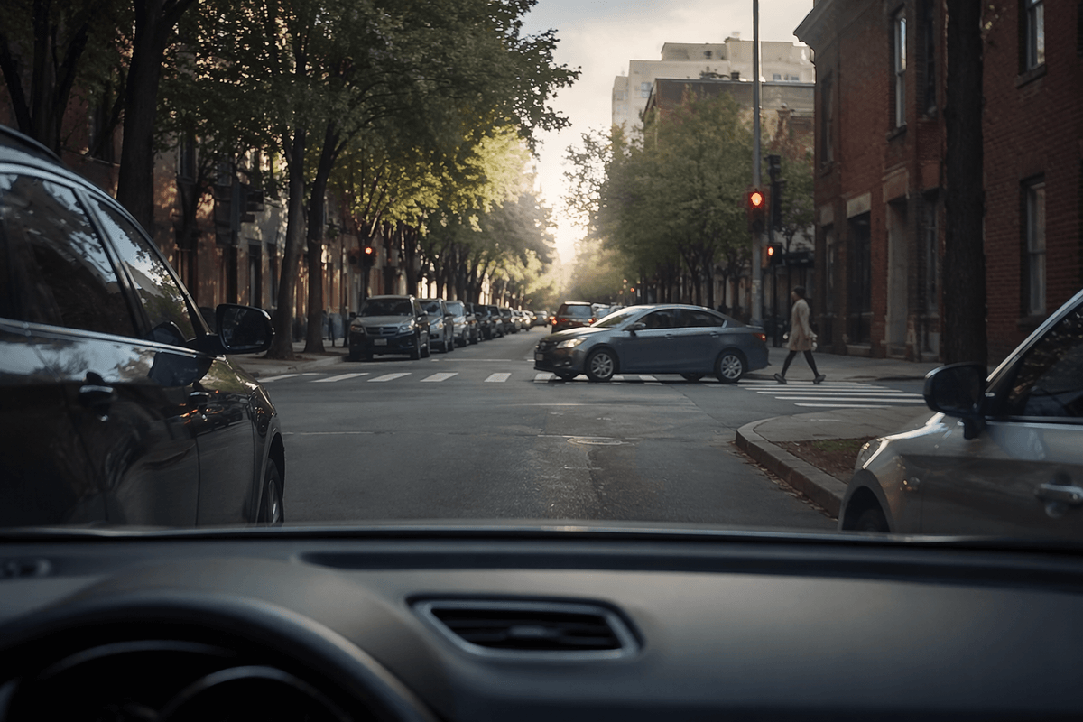
Think about a four-way stop with uneven visibility. You can’t always tell who arrived first, someone may “wave you through,” and a driver in the opposite lane might be signaling left but actually going straight. For a self-driving system, that’s not just etiquette; it’s ambiguity in the inputs. Road rules are conditional (“yield unless…,” “turn on green unless pedestrians…”) and the system has to apply them while other people sometimes don’t.
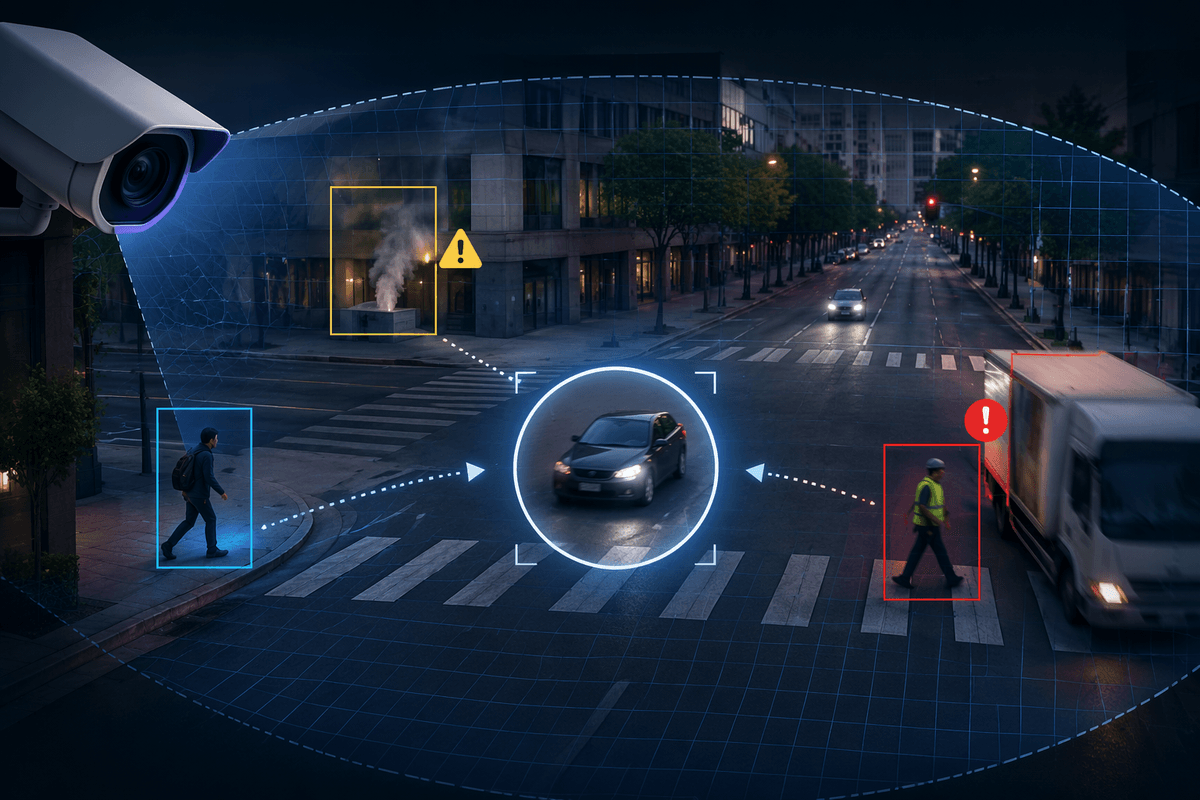
Intersections also compress a lot of rare-but-important events into a small space. A pedestrian can emerge from behind a parked SUV, a cyclist can appear between queued cars, or an oncoming vehicle can accelerate to beat a yellow. Those are hard because they combine occlusion (you can’t see them early), tight timing (seconds matter), and multiple plausible futures. The “playing it safe” often means waiting longer, which can block traffic or trigger risky human workarounds like cutting in front.
How AI builds a live map of who’s where
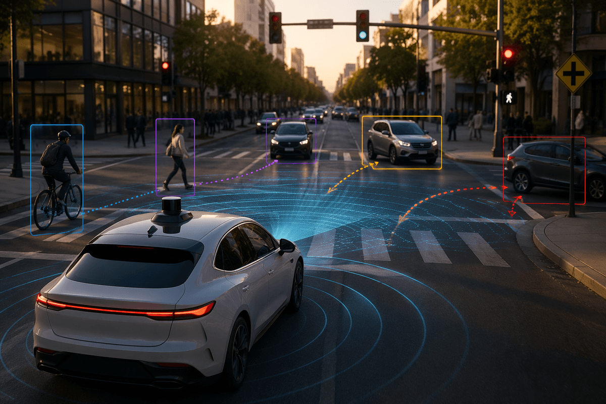
Pull up to a busy intersection and you’ll notice how quickly “who’s where” changes: a car edges forward, a cyclist slips up the right side, a pedestrian pauses then commits. A self-driving system turns that mess into a continuously updated scene map. Cameras, radar, and sometimes lidar each contribute different strengths—cameras help interpret signals and lane markings, radar is steady on speed and distance in rain or glare, and lidar (when used) adds crisp depth. Software then detects and classifies objects, estimates their positions, and “tracks” them across frames so a single cyclist doesn’t look like a new surprise every tenth of a second.
That map is built in the car’s local coordinates and constantly aligned to a broader reference: a GPS/IMU estimate, a pre-built road map, and live cues like curbs and lane lines. Occluded zones get treated as risk areas, not empty space, and sensor disagreements have to be reconciled. More sensors and compute help, but add cost, power draw, and calibration headaches that can still show up as gaps at the worst moments.
Predicting what others will do in the next seconds
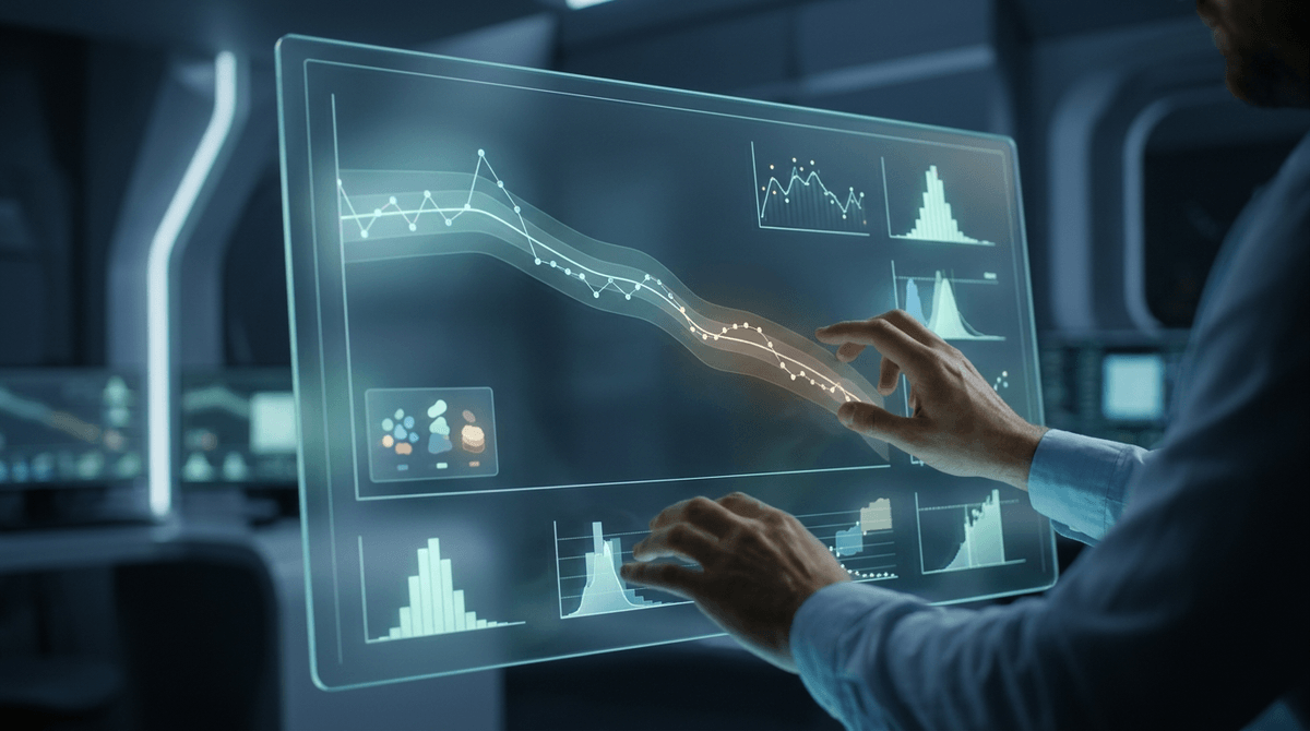
At an intersection, knowing where everyone is isn’t enough; the system has to guess what they’ll do next, and it has to do it fast. For each nearby car, cyclist, and pedestrian, prediction models generate a handful of likely short-term paths—go straight, turn, slow, stop—and attach probabilities that update several times a second. Good predictors don’t treat motion like a simple extrapolation. They factor in context: turn signals, wheel angle, lane geometry, crosswalks, traffic lights, typical yielding behavior, and the way drivers “creep” forward when they’re about to go.
A driver might proceed because you waited, or hesitate because you edged forward. Many systems handle this by simulating multiple futures and planning around the most dangerous plausible ones, not just the most likely. The limitation is fundamental: if someone is occluded or acts erratically, the model can only spread risk, which often means slower, more conservative gaps—and occasional frustration from humans behind.
Choosing a safe gap: rules, planning, and “social” driving
At this point the system has a rulebook (“who yields to whom”) and a set of predicted near-futures, but it still has to pick a moment to go. Gap selection is basically a timed commitment: the planner searches for a path through the intersection that stays inside lanes, respects signals and right-of-way, and keeps a buffer from every plausible trajectory around it. Instead of one plan, it scores many candidates—wait, creep, start a turn then pause—and rejects anything that would require another road user to brake hard or that would enter an occluded zone too quickly.
That’s where “social” driving shows up, but in a constrained way. The car may inch forward to improve visibility and communicate intent, or accept a smaller (still safe) gap when it’s clearly being yielded to, because endless waiting can create its own risk. The hard trade-off is comfort and traffic flow versus caution: conservative thresholds reduce crash risk but can stall at busy unprotected left turns, and being more assertive can look smooth while quietly increasing exposure if prediction is wrong.
When traffic lights aren’t enough: V2X and smart intersections
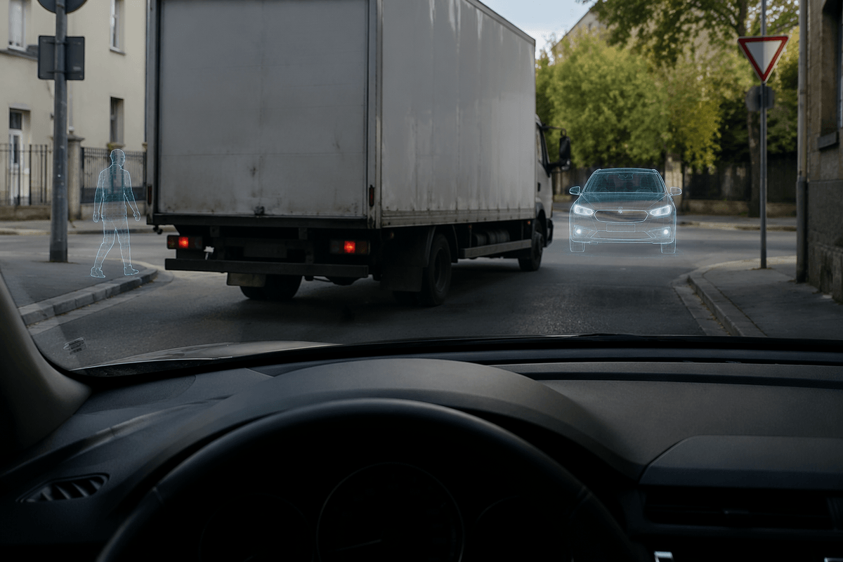
You’ve probably seen a situation where the light is green, but the intersection still feels unsafe: a truck blocks the view of oncoming traffic, a pedestrian is hidden behind a bus shelter, or a siren is approaching from somewhere you can’t see. Vehicle-to-everything (V2X) aims to reduce that “blind decision” by sharing basic facts over wireless links—signal phase and timing from the controller, warnings about a red-light runner, or a message from an emergency vehicle. Smart intersections push this further with roadside sensors (cameras, radar, lidar) that can detect road users in occluded areas and broadcast an “object list” so the car’s planner can treat it like another trusted sensor feed.
Cities have to buy, install, and maintain equipment, and coverage is uneven. V2X messages can be late, missing, or inconsistent across standards, so a safe system treats them as helpful hints, not permission to take risks. The best results come when infrastructure fills in the exact gaps that onboard sensors struggle with: occlusion and timing.
Proving it’s safe: testing, edge cases, and fallback behaviors
You can feel the safety question most at a tricky unprotected left: it’s not about one perfect sensor reading, it’s whether the whole stack behaves well when something unexpected happens. Proving that means layered evidence—simulation that generates millions of weird intersection combinations, closed-course tests that recreate specific failures (glare, cut-ins, jaywalkers), and carefully monitored on-road miles with detailed “disengagement” reviews when the system hands back control.
Edge cases never fully disappear, so the real test is the fallback. When uncertainty spikes—occlusion, conflicting signals, or an object that can’t be classified—the system should slow, create space, and choose a conservative stop without getting stuck indefinitely. That caution has costs: longer trips, more hesitation, and more pressure from impatient human drivers behind.